72km.org
Home
Travel
Our tips for traveling by bicycle
Our trips in Central America,
Europe and Across the USA
Always following the Rule:
A mile at the beginning of the day is not as long as the mile at the end of the day.
Voices & Words
Articles published, articles written, histories of the families, and of course food seen and enjoyed.
Who We Are
M & Z on bikes and hikes
Click Below for Travel Days
Friday, July 19, 2002

Go to Saturday Jul 20 >
Missoula is just 11 miles north of Lolo. Five valleys converge in the Missoula area. Lewis and Party stopped at the confluence of the Rattlesnake and Clark's Fork Rivers on July 3, 1806 before heading east over the Great Divide. Of course all of who love the Columbia Gorge thank the Missoula Flood for providing such a wonderful back yard to Portland, OR.
The Raven's Cafe in Missoula is very like an assembly of two different cultural watersheds: camouflaged man ordering quiche; pool tables and pesto chicken; tattoo and pierced looking at the Wall Street Journal. I had a great chicken quesadilla late at night and had a terrific omelet with bacon and Gorgonzola with sprouts. The garden ice tea rated very superb. A four glass rating with 4 lemons.
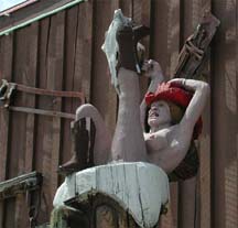
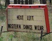
Montanan's have a funny sense of humor not only in how they make their root beer floats but also in their sculptures.

Farther down the very busy Rt. 93 was Traveler's State Park which had only become a real park two weeks ago. Plus last night, July 18, a discovery of mercury was made. The archaeologists had made maps of this park area and used infrared images. The images revealed TP sites, 4 camp circles, a rectangle latrine like area, and two campfire circles on the bluff over looking the 4 circles. The Lewis and Clark corps kept their military formation in creating a latrine. Plus, the latrine area provided the mercury which can be traced to the purgative which Lewis fed his men to cure everything. Leave No Trace has a New Meaning Now.
In the heat of the day, you could smell the pine wafting at you when the wind changed directions. I had a strong head wind and could only go about 10 miles an hour. When it faded, I was able to go about 14 m.p.h.
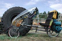
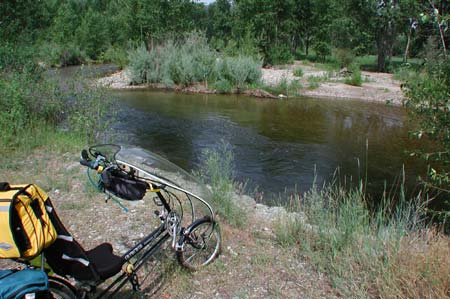
I drank about a gallon of ice tea and gatorade and didn't pee once. When I stopped, I began to sweat. The faring on the bike was very helpful and didn't make it too hot. It gave a slight breeze as I went down the road.
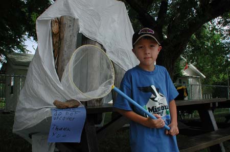

The Traveller's Rest State Park is run by a volunteer, Sherrie and her 10 year old son who became interested in Lewis and Clark at the age of four. He talked his mom into volunteering. He is starting a bug collection in between the his recording of each visitor's statistics.
Today I heard two people that sound exactly like Sarah Vowel (from This American Life).
The road up to Lolo Hot Springs was a very slow grade up.
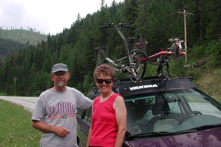
Encountered two other recumbent riders who were doing a major tour with a burley trailer and a car.


After 43.6 miles I was tired and checked into a place that had no phones or calling cards for sale.
But a hot tub fed by the Lolo Hot Springs was a mighty fine place to be at the end of today.
Fort Fizzle is another example of American military intelligence.
Lewis & Clark reached the Continental Divide in the Bitterroot Valley on Aug 12, 1805. They left Traveler' Rest on Sep 11, 1805. By Sep 22, they plagued by diarrhea, rashes, lethargy and other symptoms of malnutrition. The luckily found the home of the Nez Pearce who generously helped them.
Now flash forward to the late 1870's. The US Government forced the Nez Pearce to move onto Idaho reservations. Some did not. Warfare broke out. Soldiers and citizens tried to block passages thru the Bitterroots. One confrontation was at Fort Fizzle. One half mile west of Fort Fizzle, a narrow ravine runs north from Lolo Creek. In the early morning of the fourth day standoff, the Nez Perce ascended the ridge next to the ravine. The Nez Perce climbed the ridge and headed east. A numbers of warriors appeared along the crest and taunted the soldiers who were completely out of reach. Kind of reminded me of all the tunnels built by the North Vietnamese or perhaps the Agfhan-Pakastani borders.
Peter my friend from Denver sent me a report from a GPS program: "Within 213 miles, you will climb 13,222 ft. for 107.9 miles and descend 15,818 ft. for 105.4 miles." Yikes!
End Friday
Go to Saturday Jul 20 >
Return to Home Jul 18 >